NETWORK BANNER ADS

  • Home
  • Map Search
  • Public Land
  • Community
  • Directory
      • Back
      • LISTINGS
  • SEARCH
  • Public Land

Chapel Gorge Trail - Dells of the Wisconsin River

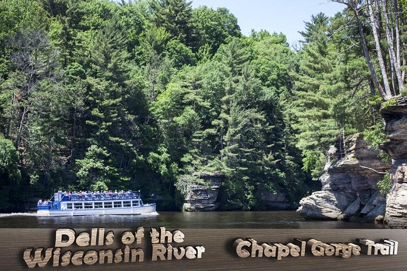
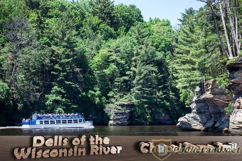
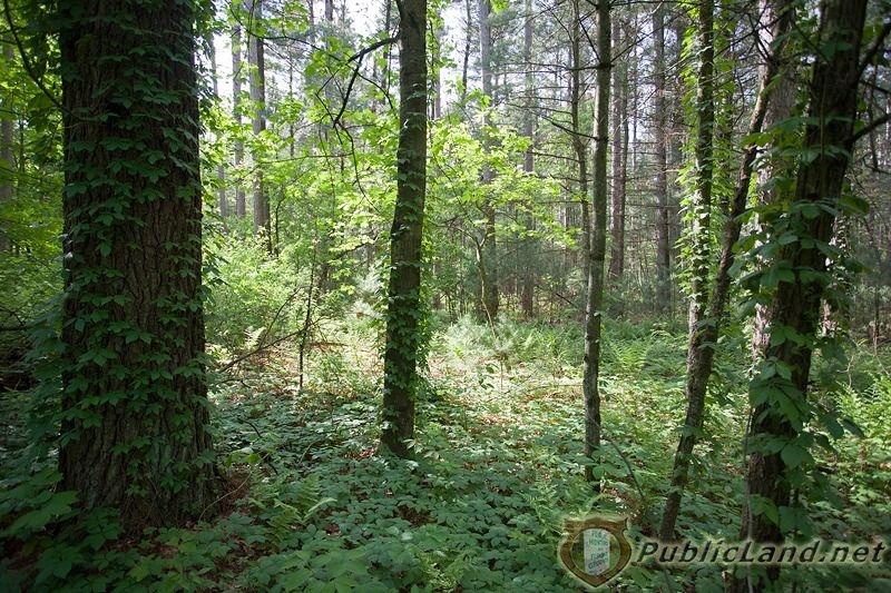
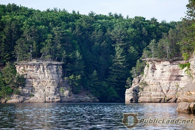
Chapel Gorge Trail - Dells of the Wisconsin River - South Parking Lot is located on River Road East of the Wisconsin River and North of Wisconsin Dells. The parking lot starts the Chapel Gorge Trail that goes through the woods and turns into a loop. At the end of the loop is a nice sandy beach on the river. This is basically the only spot on the East side of the Wisconsin River in the State Natural Area where you can get to the water. The rest of the shoreline is closed due to safety concerns because of the steepness and to protect the lands natural features. The hiking trail is 1.62 miles long in total with a maximum altitude of 1,010 ft above sea level. At the beach area you can see parts of the 5 mile long gorge where the river caved away exposing some of the Cambrian Sandstone cliffs, canyons and rock formations.

Note: You must park in the designated parking area and NOT on the street or your vehicle might be towed!

Sign: Open to hiking and other foot travel. CLOSED to Horses, Bicycles, and Motorized Vehicles and NO Fires, Camping, Glass Containers, Trash, Hiking in Closed Areas, Overnight Mooring of Boats on Sand Bars, Pets off Leashes (except actively hunting in season). Hunting is Allowed see additional postings during season…

Dells of the Wisconsin River - Witches Gulch Trail (North Parking Lot) | Chapel Gorge Trail (South Parking Lot) | 61st Street Parking Area | Wisconsin River

Dells of the Wisconsin River State Natural Area

Chapel Gorge Trail

Dells of the Wisconsin River State Natural Area is owned by the Wisconsin Department of Natural Resources, also known as the Wisconsin DNR. It is located in the Wisconsin Dells ,WI 53965 area at the intersection of four counties: Columbia, Juneau, Sauk and Adams counties. The Dells of the Wisconsin River is a gorge about 5 miles long carved out by the Wisconsin River. It features rock formations, cliffs, tributary canyons and amazing views. There are three main parking areas giving access to the public areas all North of The Dells; one on the West side of the river and two on the East side. All three locations offer trails for hiking. Some parts of the State Natural Area are not open to the public, mainly along the river with steep banks. There is also a section leased out by one of the local river boat tour companies.

WI DNR Sign Reads: “Area Open – 5:00 am to 10 pm between May 15 and September 15th and 5:00 am to 8:00 pm between September 16 and May 14. NO Fires, NO Camping, NO Glass Containers.”

Dells of the Wisconsin River

  • D 800X533 Chapel Gorge Trail IMG 3617
    D 800X533 Chapel Gorge Trail IMG 3617
  • D 800X533 Dells of The Wisconsin River SNA South of Dells
    D 800X533 Dells of The Wisconsin River SNA   South of Dells
  • D 800X533 IMG 3603
    D 800X533 IMG 3603
  • D 800X533 IMG 3610
    D 800X533 IMG 3610
  • D 800X533 IMG 3611
    D 800X533 IMG 3611
  • D 800X533 IMG 3492
    D 800X533 IMG 3492
  • D 800X533 IMG 3493
    D 800X533 IMG 3493
  • D 800X533 IMG 3494
    D 800X533 IMG 3494
  • D 800X533 IMG 3499
    D 800X533 IMG 3499
  • D 800X533 IMG 3525
    D 800X533 IMG 3525
  • D 800X533 IMG 3506
    D 800X533 IMG 3506
  • D 800X533 IMG 3507
    D 800X533 IMG 3507
  • D 800X533 IMG 3508
    D 800X533 IMG 3508
  • D 800X533 IMG 3509
    D 800X533 IMG 3509
  • D 800X533 IMG 3514
    D 800X533 IMG 3514
  • D 800X533 IMG 3515
    D 800X533 IMG 3515
  • D 800X533 IMG 3516
    D 800X533 IMG 3516
  • D 800X533 IMG 3518
    D 800X533 IMG 3518
  • D 800X533 IMG 3520
    D 800X533 IMG 3520
  • D 800X533 IMG 3572
    D 800X533 IMG 3572
  • D 800X533 IMG 3576
    D 800X533 IMG 3576
  • D 800X533 IMG 3577
    D 800X533 IMG 3577
  • D 800X533 IMG 3578
    D 800X533 IMG 3578
  • D 800X533 IMG 3581
    D 800X533 IMG 3581
  • D 800X533 IMG 3582
    D 800X533 IMG 3582
  • D 800X533 IMG 3589
    D 800X533 IMG 3589
  • D 800X533 IMG 3591
    D 800X533 IMG 3591
  • D 800X533 IMG 3599
    D 800X533 IMG 3599
Views
/28
  • D 800X533 Chapel Gorge Trail IMG 3617
  • D 800X533 Dells of The Wisconsin River SNA   South of Dells
  • D 800X533 IMG 3603
  • D 800X533 IMG 3610
  • D 800X533 IMG 3611
  • D 800X533 IMG 3492
  • D 800X533 IMG 3493
  • D 800X533 IMG 3494
  • D 800X533 IMG 3499
  • D 800X533 IMG 3525
  • D 800X533 IMG 3506
  • D 800X533 IMG 3507
  • D 800X533 IMG 3508
  • D 800X533 IMG 3509
  • D 800X533 IMG 3514
  • D 800X533 IMG 3515
  • D 800X533 IMG 3516
  • D 800X533 IMG 3518
  • D 800X533 IMG 3520
  • D 800X533 IMG 3572
  • D 800X533 IMG 3576
  • D 800X533 IMG 3577
  • D 800X533 IMG 3578
  • D 800X533 IMG 3581
  • D 800X533 IMG 3582
  • D 800X533 IMG 3589
  • D 800X533 IMG 3591
  • D 800X533 IMG 3599
    Views
    /28
    • D 800X533 Chapel Gorge Trail IMG 3617
    • D 800X533 Dells of The Wisconsin River SNA   South of Dells
    • D 800X533 IMG 3603
    • D 800X533 IMG 3610
    • D 800X533 IMG 3611
    • D 800X533 IMG 3492
    • D 800X533 IMG 3493
    • D 800X533 IMG 3494
    • D 800X533 IMG 3499
    • D 800X533 IMG 3525
    • D 800X533 IMG 3506
    • D 800X533 IMG 3507
    • D 800X533 IMG 3508
    • D 800X533 IMG 3509
    • D 800X533 IMG 3514
    • D 800X533 IMG 3515
    • D 800X533 IMG 3516
    • D 800X533 IMG 3518
    • D 800X533 IMG 3520
    • D 800X533 IMG 3572
    • D 800X533 IMG 3576
    • D 800X533 IMG 3577
    • D 800X533 IMG 3578
    • D 800X533 IMG 3581
    • D 800X533 IMG 3582
    • D 800X533 IMG 3589
    • D 800X533 IMG 3591
    • D 800X533 IMG 3599

    Chapel Gorge Trail Photos


    Wisconsin River 

    The Wisconsin River is about 430 miles long and is known for its amazing historical background Several popular flowages are created from it including Lake Du Bay, Lake Petenwell and Castle Rock Lake.  The river begins at the northeast corner of Wisconsin flowing southwest and ends in the west central part of the state at the Mississippi River.  One of the most popular sections of the river is about 5 miles long which is known as the Dells of the Wisconsin River. It is better known as the famous Wisconsin Dells that is filled with fun attractions and historical landmarks.  Thousands of years ago the ice that formed Lake Wisconsin melted away causing an overflow which cut a portion of the Wisconsin River out. In turn that created the Wisconsin Dells that had previously been called Kilbourn. Today the river offers outdoor activities like swimming, boating, kayaking, fishing, canoeing, tubing, photography, sitting by the water and even transportation. There are all types of aquatic life here including clams, catfish, sturgeon, musky, bass, panfish, mud puppies, snakes, turtles, and also terrestrial wildlife including deer, turkeys, bald eagles, cranes, song birds, and more that live in and around the mighty Wisconsin River.

    Wisconsin Dells WI 53965

    Nearby Villages, Towns and Cities

    • Wisconsin Dells
    • Lake Delton
    • Plainville
    • Briggsville
    • Lyndon Station
    • Dellwood (In Sauk County)
    • Reedsburg
    • Rock Springs
    • Baraboo
    • Pecks Corners
    • Green Corners
    • Lewiston
    • Big Spring
    • Davis Corners

    Nearby Lakes, Rivers, Creeks and Trout Streams

    • Wisconsin River 
    • Castle Rock Lake
    • Lake Delton
    • Mirror Lake
    • Mason Lake
    • Lemonweir River
    • Amey Pond
    • Gulch Creek Trout Stream
    • Fawn Lake
    • Trout Creek
    • Lake Blass
    • Beaver Creek
    • Lake Dellona
    • Weeting Lake
    • Corning Lake
    • Shadduck Creek
    • Gilmore Creek
    • Hulburt Creek

    Nearby Area Features & Wisconsin Public Land

    • Wisconsin River Journey
    • Wisconsin Dells Riverwalk
    • Dells of the Wisconsin River State Natural Area
    • Dell Creek State Wildlife Area 
    • Rocky Arbor State Park
    • Mirror Lake Pine Oak Forest State Natural Park
    • Mirror Lake State Park
    • Kilbourn Dam
    • Hulburt Creek Fishery Area
    • Hulburt Creek Woods SNA
    • Fern Gorge State Natural Area
    • Lemonweir Bottomland Hardwood Forest State Natural Area
    • Amey Pond Fish and Wildlife Area
    • Pine Island State Wildlife Area
    • International Crane Foundation

    Rock Formations

    • Coon Bluff
    • Rattlesnake Knob
    • Haystack Hills
    • Grubb Hill
    • Bald Knob
    • Moran Bluff

    Featured Wisconsin Dells Area Real Estate for Sale

    WI Cabins & Homes for Sale

    Wisconsin Land & Acreage for Sale

    Commercial Buildings

    Condos

    Multi-Family

    Chapel Gorge Trail - Dells of the Wisconsin River

    Chapel Gorge Trail

    Details
    Hits: 1453
    • Wisconsin River
    • Wisconsin Dells
    • Wisconsin Dells, WI. 53965
    • The Dells
    • Water Capital of the World
    • Boat Tours
    • River Tours
    • GoPro Video
    • Video
    • Photos
    • Dells of The Wisconsin River Natural Area
    • Adams County Wisconsin
    • Dells of the Wisconsin River
    • Witches Gulch Trail
    • Chapel Gorge Trail
    • North Parking Lot
    • South Parking Lot
    • Adams County WI

    Witches Gulch Trail - Dells of the Wisconsin River

    Witches Gulch Trail - Dells of the Wisconsin River - North Parking Lot area is located on River Road East of the Wisconsin River and North of Wisconsin Dells along Witches Gulch, which is part of the Dells of the Wisconsin River. There is a section of it along the Gulch that is not open to the public due to a private lease with one of the local river boat tour companies. The rest of the area is open to the public and is mostly used for hiking on the Witches Gulch Trail. Some parts right around the Wisconsin River are not open to the public for safety reasons because of the steepness. This area is mostly large pine trees. A sign there reads “140,000 Pines Planted in The Dells 1925 – 1926”. There are lots of ferns, wild flowers, vines, mushrooms, berries, moss and maple trees. The terrain there is lightly rolling for the most part, but steep by the river. This part of the Dells of the Wisconsin River State Natural Area is home to Whitetail Deer, Wild Turkey, Squirrels, Coyotes, Birds of Prey, Song Birds, Wood Chucks, Porcupines, Chipmunks, Snakes and other Wisconsin Wildlife.

    Dells of the Wisconsin River - Witches Gulch Trail (North Parking Lot) | Chapel Gorge Trail (South Parking Lot) | 61st Street Parking Area | Wisconsin River

    Dells of the Wisconsin River State Natural Area

    Witches Gulch Trail

    Dells of the Wisconsin River State Natural Area is owned by the Wisconsin Department of Natural Resources, also known as the Wisconsin DNR. It is located in the Wisconsin Dells ,WI 53965 area at the intersection of four counties: Columbia, Juneau, Sauk and Adams counties. The Dells of the Wisconsin River is a gorge about 5 miles long carved out by the Wisconsin River. It features rock formations, cliffs, tributary canyons and amazing views. There are three main parking areas giving access to the public areas all North of The Dells; one on the West side of the river and two on the East side. All three locations offer trails for hiking. Some parts of the State Natural Area are not open to the public, mainly along the river with steep banks. There is also a section leased out by one of the local river boat tour companies.

    WI DNR Sign Reads: “Area Open – 5:00 am to 10 pm between May 15 and September 15th and 5:00 am to 8:00 pm between September 16 and May 14. NO Fires, NO Camping, NO Glass Containers.”

    Dells of the Wisconsin River

    • D 800X533 Witches Gulch Trail IMG 3443
      D 800X533 Witches Gulch Trail IMG 3443
    • D 800X533 Dells of The Wisconsin River SNA On River Adams County
      D 800X533 Dells of The Wisconsin River SNA   On River Adams County
    • D 800X533 IMG 3478
      D 800X533 IMG 3478
    • D 800X533 IMG 3479
      D 800X533 IMG 3479
    • D 800X533 IMG 3483
      D 800X533 IMG 3483
    • D 800X533 IMG 3425
      D 800X533 IMG 3425
    • D 800X533 IMG 3426
      D 800X533 IMG 3426
    • D 800X533 IMG 3427
      D 800X533 IMG 3427
    • D 800X533 IMG 3428
      D 800X533 IMG 3428
    • D 800X533 IMG 3429
      D 800X533 IMG 3429
    • D 800X533 IMG 3430
      D 800X533 IMG 3430
    • D 800X533 IMG 3431
      D 800X533 IMG 3431
    • D 800X533 IMG 3432
      D 800X533 IMG 3432
    • D 800X533 IMG 3434
      D 800X533 IMG 3434
    • D 800X533 IMG 3438
      D 800X533 IMG 3438
    • D 800X533 IMG 3443
      D 800X533 IMG 3443
    • D 800X533 IMG 3446
      D 800X533 IMG 3446
    • D 800X533 IMG 3447
      D 800X533 IMG 3447
    • D 800X533 IMG 3451
      D 800X533 IMG 3451
    • D 800X533 IMG 3452
      D 800X533 IMG 3452
    • D 800X533 IMG 3458
      D 800X533 IMG 3458
    • D 800X533 IMG 3473
      D 800X533 IMG 3473
    • D 800X533 IMG 3476
      D 800X533 IMG 3476
    Views
    /23
    • D 800X533 Witches Gulch Trail IMG 3443
    • D 800X533 Dells of The Wisconsin River SNA   On River Adams County
    • D 800X533 IMG 3478
    • D 800X533 IMG 3479
    • D 800X533 IMG 3483
    • D 800X533 IMG 3425
    • D 800X533 IMG 3426
    • D 800X533 IMG 3427
    • D 800X533 IMG 3428
    • D 800X533 IMG 3429
    • D 800X533 IMG 3430
    • D 800X533 IMG 3431
    • D 800X533 IMG 3432
    • D 800X533 IMG 3434
    • D 800X533 IMG 3438
    • D 800X533 IMG 3443
    • D 800X533 IMG 3446
    • D 800X533 IMG 3447
    • D 800X533 IMG 3451
    • D 800X533 IMG 3452
    • D 800X533 IMG 3458
    • D 800X533 IMG 3473
    • D 800X533 IMG 3476
      Views
      /23
      • D 800X533 Witches Gulch Trail IMG 3443
      • D 800X533 Dells of The Wisconsin River SNA   On River Adams County
      • D 800X533 IMG 3478
      • D 800X533 IMG 3479
      • D 800X533 IMG 3483
      • D 800X533 IMG 3425
      • D 800X533 IMG 3426
      • D 800X533 IMG 3427
      • D 800X533 IMG 3428
      • D 800X533 IMG 3429
      • D 800X533 IMG 3430
      • D 800X533 IMG 3431
      • D 800X533 IMG 3432
      • D 800X533 IMG 3434
      • D 800X533 IMG 3438
      • D 800X533 IMG 3443
      • D 800X533 IMG 3446
      • D 800X533 IMG 3447
      • D 800X533 IMG 3451
      • D 800X533 IMG 3452
      • D 800X533 IMG 3458
      • D 800X533 IMG 3473
      • D 800X533 IMG 3476

      Witches Gulch Trail Pictures


      Wisconsin River 

      The Wisconsin River is about 430 miles long and is known for its amazing historical background Several popular flowages are created from it including Lake Du Bay, Lake Petenwell and Castle Rock Lake.  The river begins at the northeast corner of Wisconsin flowing southwest and ends in the west central part of the state at the Mississippi River.  One of the most popular sections of the river is about 5 miles long which is known as the Dells of the Wisconsin River. It is better known as the famous Wisconsin Dells that is filled with fun attractions and historical landmarks.  Thousands of years ago the ice that formed Lake Wisconsin melted away causing an overflow which cut a portion of the Wisconsin River out. In turn that created the Wisconsin Dells that had previously been called Kilbourn. Today the river offers outdoor activities like swimming, boating, kayaking, fishing, canoeing, tubing, photography, sitting by the water and even transportation. There are all types of aquatic life here including clams, catfish, sturgeon, musky, bass, panfish, mud puppies, snakes, turtles, and also terrestrial wildlife including deer, turkeys, bald eagles, cranes, song birds, and more that live in and around the mighty Wisconsin River.

      Wisconsin Dells WI 53965

      Nearby Villages, Towns and Cities

      • Wisconsin Dells
      • Lake Delton
      • Plainville
      • Briggsville
      • Lyndon Station
      • Dellwood (In Sauk County)
      • Reedsburg
      • Rock Springs
      • Baraboo
      • Pecks Corners
      • Green Corners
      • Lewiston
      • Big Spring
      • Davis Corners

      Nearby Lakes, Rivers, Creeks and Trout Streams

      • Wisconsin River 
      • Castle Rock Lake
      • Lake Delton
      • Mirror Lake
      • Mason Lake
      • Lemonweir River
      • Amey Pond
      • Gulch Creek Trout Stream
      • Fawn Lake
      • Trout Creek
      • Lake Blass
      • Beaver Creek
      • Lake Dellona
      • Weeting Lake
      • Corning Lake
      • Shadduck Creek
      • Gilmore Creek
      • Hulburt Creek

      Nearby Area Features & Wisconsin Public Land

      • Wisconsin River Journey
      • Wisconsin Dells Riverwalk
      • Dells of the Wisconsin River State Natural Area
      • Dell Creek State Wildlife Area 
      • Rocky Arbor State Park
      • Mirror Lake Pine Oak Forest State Natural Park
      • Mirror Lake State Park
      • Kilbourn Dam
      • Hulburt Creek Fishery Area
      • Hulburt Creek Woods SNA
      • Fern Gorge State Natural Area
      • Lemonweir Bottomland Hardwood Forest State Natural Area
      • Amey Pond Fish and Wildlife Area
      • Pine Island State Wildlife Area
      • International Crane Foundation

      Rock Formations

      • Coon Bluff
      • Rattlesnake Knob
      • Haystack Hills
      • Grubb Hill
      • Bald Knob
      • Moran Bluff

      Featured Wisconsin Dells Area Real Estate for Sale

      WI Cabins & Homes for Sale

      Wisconsin Land & Acreage for Sale

      Commercial Buildings

      Condos

      Multi-Family

      Witches Gulch Trail Dells of the Wisconsin River State Natural Area

      Witches Gulch Trail

      Details
      Hits: 1645
      • Wisconsin River
      • Wisconsin Dells
      • Wisconsin Dells, WI. 53965
      • The Dells
      • Water Capital of the World
      • Boat Tours
      • River Tours
      • GoPro Video
      • Video
      • Photos
      • Dells of The Wisconsin River Natural Area
      • Adams County Wisconsin
      • Dells of the Wisconsin River
      • Witches Gulch Trail
      • Chapel Gorge Trail
      • North Parking Lot
      • South Parking Lot
      • Adams County WI

      61st Street Parking Area - Dells of the Wisconsin River

      61st Street Parking Area - Dells of the Wisconsin River is located on the West side of the Wisconsin River, North of Wisconsin Dells and is also part of Dells of the Wisconsin River State Natural Area. It is the best maintained but probably the least attended parking lot. It’s set in the rolling terrain behind some small farms and most wouldn’t even think to venture back to this hidden gem. There is a good sized paved parking lot with a large restroom building, information kiosk, an overlook of the river with a deck and sitting benches with a small mowed path creating a trail. The coolest feature of this part of the State Natural area is an old boat launch that is now closed with a paved road that goes down to a bay of the Wisconsin River. The bay features cliffs on two sides with woods behind on a very wide section of the river that has a sandy beach. This is a picture perfect setting especially when the sky is bright blue with big fluffy clouds. Throw in a fishing line while you watch the area wildlife, jumping fish and in the warmer months observe a variety of river boats cruising the waters. This part of the Dells of the Wisconsin River requires a State Park Sticker to enter!

      A plaque attached to a rock overlooking the river by a wooden bench reads: “Dells of the Wisconsin River – This area of striking geological features, natural communities, and rare plants and animals is dedicated to scientific research, the teaching of natural history, and the preservation of its wild and scenic values for future generations. Wisconsin Department of Natural Resources June 23, 1997”

      Dells of the Wisconsin River - Witches Gulch Trail (North Parking Lot) | Chapel Gorge Trail (South Parking Lot) | 61st Street Parking Area | Wisconsin River

      Dells of the Wisconsin River State Natural Area

      61st Street Parking Area

      Dells of the Wisconsin River State Natural Area is owned by the Wisconsin Department of Natural Resources, also known as the Wisconsin DNR. It is located in the Wisconsin Dells ,WI 53965 area at the intersection of four counties: Columbia, Juneau, Sauk and Adams counties. The Dells of the Wisconsin River is a gorge about 5 miles long carved out by the Wisconsin River. It features rock formations, cliffs, tributary canyons and amazing views. There are three main parking areas giving access to the public areas all North of The Dells; one on the West side of the river and two on the East side. All three locations offer trails for hiking. Some parts of the State Natural Area are not open to the public, mainly along the river with steep banks. There is also a section leased out by one of the local river boat tour companies.

      WI DNR Sign Reads: “Area Open – 5:00 am to 10 pm between May 15 and September 15th and 5:00 am to 8:00 pm between September 16 and May 14. NO Fires, NO Camping, NO Glass Containers.”

      Dells of the Wisconsin River

      • D 800X533 61st Street Dells of the WI River SNA GOPR0194
        D 800X533 61st Street Dells of the WI River SNA GOPR0194
      • D 800X533 Northwest Parking Area Dells of the Wisconsin River SNA 1
        D 800X533 Northwest Parking Area Dells of the Wisconsin River SNA 1
      • D 800X533 IMG 3737
        D 800X533 IMG 3737
      • D 800X533 IMG 3730
        D 800X533 IMG 3730
      • D 800X533 IMG 3688
        D 800X533 IMG 3688
      • D 800X533 IMG 3692
        D 800X533 IMG 3692
      • D 800X533 IMG 3687
        D 800X533 IMG 3687
      • D 800X533 IMG 3690
        D 800X533 IMG 3690
      • D 800X533 IMG 3691
        D 800X533 IMG 3691
      • D 800X533 IMG 3697
        D 800X533 IMG 3697
      • D 800X533 IMG 3696
        D 800X533 IMG 3696
      • D 800X533 IMG 3701
        D 800X533 IMG 3701
      • D 800X533 IMG 3702
        D 800X533 IMG 3702
      • D 800X533 IMG 3703
        D 800X533 IMG 3703
      • D 800X533 IMG 3705
        D 800X533 IMG 3705
      • D 800X533 IMG 3706
        D 800X533 IMG 3706
      • D 800X533 IMG 3713
        D 800X533 IMG 3713
      • D 800X533 IMG 3714
        D 800X533 IMG 3714
      • D 800X533 IMG 3715
        D 800X533 IMG 3715
      • D 800X533 IMG 3716
        D 800X533 IMG 3716
      • D 800X533 IMG 3725
        D 800X533 IMG 3725
      • D 800X533 IMG 3727
        D 800X533 IMG 3727
      • D 800X533 IMG 3729
        D 800X533 IMG 3729
      • D 800X533 Dells of The Wisconsin River SNA Area
        D 800X533 Dells of The Wisconsin River SNA   Area
      • D 800X533 IMG 3735
        D 800X533 IMG 3735
      • D 800X533 IMG 3771
        D 800X533 IMG 3771
      • D 800X533 IMG 3739
        D 800X533 IMG 3739
      • D 800X533 IMG 6094
        D 800X533 IMG 6094
      • D 800X533 Dells of The Wisconsin River SNA Juneau Cty
        D 800X533 Dells of The Wisconsin River SNA   Juneau Cty
      • D2 800X533 IMG 3750
        D2 800X533 IMG 3750
      • D2 800X533 IMG 3749
        D2 800X533 IMG 3749
      • D 800X533 IMG 3764
        D 800X533 IMG 3764
      • D 800X533 IMG 3766
        D 800X533 IMG 3766
      • D 800X533 IMG 3762
        D 800X533 IMG 3762
      • D 800X533 IMG 3759
        D 800X533 IMG 3759
      Views
      /35
      • D 800X533 61st Street Dells of the WI River SNA GOPR0194
      • D 800X533 Northwest Parking Area Dells of the Wisconsin River SNA 1
      • D 800X533 IMG 3737
      • D 800X533 IMG 3730
      • D 800X533 IMG 3688
      • D 800X533 IMG 3692
      • D 800X533 IMG 3687
      • D 800X533 IMG 3690
      • D 800X533 IMG 3691
      • D 800X533 IMG 3697
      • D 800X533 IMG 3696
      • D 800X533 IMG 3701
      • D 800X533 IMG 3702
      • D 800X533 IMG 3703
      • D 800X533 IMG 3705
      • D 800X533 IMG 3706
      • D 800X533 IMG 3713
      • D 800X533 IMG 3714
      • D 800X533 IMG 3715
      • D 800X533 IMG 3716
      • D 800X533 IMG 3725
      • D 800X533 IMG 3727
      • D 800X533 IMG 3729
      • D 800X533 Dells of The Wisconsin River SNA   Area
      • D 800X533 IMG 3735
      • D 800X533 IMG 3771
      • D 800X533 IMG 3739
      • D 800X533 IMG 6094
      • D 800X533 Dells of The Wisconsin River SNA   Juneau Cty
      • D2 800X533 IMG 3750
      • D2 800X533 IMG 3749
      • D 800X533 IMG 3764
      • D 800X533 IMG 3766
      • D 800X533 IMG 3762
      • D 800X533 IMG 3759
        Views
        /35
        • D 800X533 61st Street Dells of the WI River SNA GOPR0194
        • D 800X533 Northwest Parking Area Dells of the Wisconsin River SNA 1
        • D 800X533 IMG 3737
        • D 800X533 IMG 3730
        • D 800X533 IMG 3688
        • D 800X533 IMG 3692
        • D 800X533 IMG 3687
        • D 800X533 IMG 3690
        • D 800X533 IMG 3691
        • D 800X533 IMG 3697
        • D 800X533 IMG 3696
        • D 800X533 IMG 3701
        • D 800X533 IMG 3702
        • D 800X533 IMG 3703
        • D 800X533 IMG 3705
        • D 800X533 IMG 3706
        • D 800X533 IMG 3713
        • D 800X533 IMG 3714
        • D 800X533 IMG 3715
        • D 800X533 IMG 3716
        • D 800X533 IMG 3725
        • D 800X533 IMG 3727
        • D 800X533 IMG 3729
        • D 800X533 Dells of The Wisconsin River SNA   Area
        • D 800X533 IMG 3735
        • D 800X533 IMG 3771
        • D 800X533 IMG 3739
        • D 800X533 IMG 6094
        • D 800X533 Dells of The Wisconsin River SNA   Juneau Cty
        • D2 800X533 IMG 3750
        • D2 800X533 IMG 3749
        • D 800X533 IMG 3764
        • D 800X533 IMG 3766
        • D 800X533 IMG 3762
        • D 800X533 IMG 3759

        61st Street Parking Area Pictures


        Wisconsin River

        The Wisconsin River is about 430 miles long and is known for its amazing historical background Several popular flowages are created from it including Lake Du Bay, Lake Petenwell and Castle Rock Lake.  The river begins at the northeast corner of Wisconsin flowing southwest and ends in the west central part of the state at the Mississippi River.  One of the most popular sections of the river is about 5 miles long which is known as the Dells of the Wisconsin River. It is better known as the famous Wisconsin Dells that is filled with fun attractions and historical landmarks.  Thousands of years ago the ice that formed Lake Wisconsin melted away causing an overflow which cut a portion of the Wisconsin River out. In turn that created the Wisconsin Dells that had previously been called Kilbourn. Today the river offers outdoor activities like swimming, boating, kayaking, fishing, canoeing, tubing, photography, sitting by the water and even transportation. There are all types of aquatic life here including clams, catfish, sturgeon, musky, bass, panfish, mud puppies, snakes, turtles, and also terrestrial wildlife including deer, turkeys, bald eagles, cranes, song birds, and more that live in and around the mighty Wisconsin River.

        Wisconsin Dells WI 53965

        Nearby Villages, Towns and Cities

        • Wisconsin Dells
        • Lake Delton
        • Plainville
        • Briggsville
        • Lyndon Station
        • Dellwood (In Sauk County)
        • Reedsburg
        • Rock Springs
        • Baraboo
        • Pecks Corners
        • Green Corners
        • Lewiston
        • Big Spring
        • Davis Corners

        Nearby Lakes, Rivers, Creeks and Trout Streams

        • Wisconsin River 
        • Castle Rock Lake
        • Lake Delton
        • Mirror Lake
        • Mason Lake
        • Lemonweir River
        • Amey Pond
        • Gulch Creek Trout Stream
        • Fawn Lake
        • Trout Creek
        • Lake Blass
        • Beaver Creek
        • Lake Dellona
        • Weeting Lake
        • Corning Lake
        • Shadduck Creek
        • Gilmore Creek
        • Hulburt Creek

        Nearby Area Features & Wisconsin Public Land

        • Wisconsin River Journey
        • Wisconsin Dells Riverwalk
        • Dells of the Wisconsin River State Natural Area
        • Dell Creek State Wildlife Area 
        • Rocky Arbor State Park
        • Mirror Lake Pine Oak Forest State Natural Park
        • Mirror Lake State Park
        • Kilbourn Dam
        • Hulburt Creek Fishery Area
        • Hulburt Creek Woods SNA
        • Fern Gorge State Natural Area
        • Lemonweir Bottomland Hardwood Forest State Natural Area
        • Amey Pond Fish and Wildlife Area
        • Pine Island State Wildlife Area
        • International Crane Foundation

        Rock Formations

        • Coon Bluff
        • Rattlesnake Knob
        • Haystack Hills
        • Grubb Hill
        • Bald Knob
        • Moran Bluff

        Featured Wisconsin Dells Area Real Estate for Sale

        WI Cabins & Homes for Sale

        Wisconsin Land & Acreage for Sale

        Commercial Buildings

        Condos

        Multi-Family

        61st Street Parking Area Dells of the Wisconsin River

        Dells of the Wisconsin River

        Details
        Hits: 1217
        • Wisconsin River
        • Wisconsin Dells
        • Wisconsin Dells, WI. 53965
        • The Dells
        • Water Capital of the World
        • Boat Tours
        • River Tours
        • GoPro Video
        • Video
        • Photos
        • Dells of The Wisconsin River Natural Area
        • Dells of the Wisconsin River
        • Witches Gulch Trail
        • Chapel Gorge Trail
        • North Parking Lot
        • South Parking Lot
        • Juneau County WI
        • Juneau County Wisconsin
        Dells of the Wisconsin River State Natural Area
        Dells of the Wisconsin River State Natural Area

        Dells of the Wisconsin River

        Dells of the Wisconsin River State Natural Area is owned by the Wisconsin Department of Natural Resources, also known as the Wisconsin DNR. It is located in the Wisconsin Dells ,WI 53965 area at the intersection of four counties: Columbia, Juneau, Sauk and Adams counties. The Dells of the Wisconsin River is a gorge about 5 miles long carved out by the Wisconsin River. It features rock formations, cliffs, tributary canyons and amazing views. There are three main parking areas giving access to the public areas all North of The Dells; one on the West side of the river and two on the East side. All three locations offer trails for hiking. Some parts of the State Natural Area are not open to the public, mainly along the river with steep banks. There is also a section leased out by one of the local river boat tour companies.

        WI DNR Sign Reads: “Area Open – 5:00 am to 10 pm between May 15 and September 15th and 5:00 am to 8:00 pm between September 16 and May 14. NO Fires, NO Camping, NO Glass Containers.”

        Dells of the Wisconsin River - Witches Gulch Trail (North Parking Lot) | Chapel Gorge Trail (South Parking Lot) | 61st Street Parking Area | Wisconsin River

        Dells of the Wisconsin River State Natural Area

        Wisconsin River

        Dells of the Wisconsin River Designated Parking Area

        North Parking Lot – Witches Gulch Trail

        This area is located on River Road East of the Wisconsin River and North of Wisconsin Dells along Witches Gulch, which is part of the Dells of the Wisconsin River. There is a section of it along the Gulch that is not open to the public due to a private lease with one of the local river boat tour companies. The rest of the area is open to the public and is mostly used for hiking on the Witches Gulch Trail. Some parts right around the Wisconsin River are not open to the public for safety reasons because of the steepness. This area is mostly large pine trees. A sign there reads “140,000 Pines Planted in The Dells 1925 – 1926”. There are lots of ferns, wild flowers, vines, mushrooms, berries, moss and maple trees. The terrain there is lightly rolling for the most part, but steep by the river. This part of the Dells of the Wisconsin River State Natural Area is home to Whitetail Deer, Wild Turkey, Squirrels, Coyotes, Birds of Prey, Song Birds, Wood Chucks, Porcupines, Chipmunks, Snakes and other Wisconsin Wildlife.

        South Parking Lot – Chapel Gorge Trail

        The South parking lot at Chapel Gorge Trail is located on River Road East of the Wisconsin River and North of Wisconsin Dells. The parking lot starts the Chapel Gorge Trail that goes through the woods and turns into a loop. At the end of the loop is a nice sandy beach on the river. This is basically the only spot on the East side of the Wisconsin River in the State Natural Area where you can get to the water. The rest of the shoreline is closed due to safety concerns because of the steepness and to protect the lands natural features. The hiking trail is 1.62 miles long in total with a maximum altitude of 1,010 ft above sea level. At the beach area you can see parts of the 5 mile long gorge where the river caved away exposing some of the Cambrian Sandstone cliffs, canyons and rock formations.

        Note: You must park in the designated parking area and NOT on the street or your vehicle might be towed!

        Sign: Open to hiking and other foot travel. CLOSED to Horses, Bicycles, and Motorized Vehicles and NO Fires, Camping, Glass Containers, Trash, Hiking in Closed Areas, Overnight Mooring of Boats on Sand Bars, Pets off Leashes (except actively hunting in season). Hunting is Allowed see additional postings during season…


        61st Street Parking Area

        The 61st Street parking area is located on the West side of the Wisconsin River, North of Wisconsin Dells and is also part of Dells of the Wisconsin River State Natural Area. It is the best maintained but probably the least attended parking lot. It’s set in the rolling terrain behind some small farms and most wouldn’t even think to venture back to this hidden gem. There is a good sized paved parking lot with a large restroom building, information kiosk, an overlook of the river with a deck and sitting benches with a small mowed path creating a trail. The coolest feature of this part of the State Natural area is an old boat launch that is now closed with a paved road that goes down to a bay of the Wisconsin River. The bay features cliffs on two sides with woods behind on a very wide section of the river that has a sandy beach. This is a picture perfect setting especially when the sky is bright blue with big fluffy clouds. Throw in a fishing line while you watch the area wildlife, jumping fish and in the warmer months observe a variety of river boats cruising the waters. This part of the Dells of the Wisconsin River requires a State Park Sticker to enter!

        A plaque attached to a rock overlooking the river by a wooden bench reads: “Dells of the Wisconsin River – This area of striking geological features, natural communities, and rare plants and animals is dedicated to scientific research, the teaching of natural history, and the preservation of its wild and scenic values for future generations. Wisconsin Department of Natural Resources June 23, 1997”

        Wisconsin River

        The Wisconsin River is about 430 miles long and is known for its amazing historical background Several popular flowages are created from it including Lake Du Bay, Lake Petenwell and Castle Rock Lake.  The river begins at the northeast corner of Wisconsin flowing southwest and ends in the west central part of the state at the Mississippi River.  One of the most popular sections of the river is about 5 miles long which is known as the Dells of the Wisconsin River. It is better known as the famous Wisconsin Dells that is filled with fun attractions and historical landmarks.  Thousands of years ago the ice that formed Lake Wisconsin melted away causing an overflow which cut a portion of the Wisconsin River out. In turn that created the Wisconsin Dells that had previously been called Kilbourn. Today the river offers outdoor activities like swimming, boating, kayaking, fishing, canoeing, tubing, photography, sitting by the water and even transportation. There are all types of aquatic life here including clams, catfish, sturgeon, musky, bass, panfish, mud puppies, snakes, turtles, and also terrestrial wildlife including deer, turkeys, bald eagles, cranes, song birds, and more that live in and around the mighty Wisconsin River.

        Dells of the Wisconsin River

        • D 800X533 Dells of Wisconsin River IMG 3424
          D 800X533 Dells of Wisconsin River IMG 3424
        • D 800X533 Witches Gulch Trail IMG 3443
          D 800X533 Witches Gulch Trail IMG 3443
        • D 800X533 61st Street Dells of the WI River SNA GOPR0194
          D 800X533 61st Street Dells of the WI River SNA GOPR0194
        • D 800X533 Chapel Gorge Trail IMG 3617
          D 800X533 Chapel Gorge Trail IMG 3617
        • D 800X533 Dells of The Wisconsin River SNA Area
          D 800X533 Dells of The Wisconsin River SNA   Area
        • D 800X533 Dells of the Wisconsin River SNA DNR MAP
          D 800X533 Dells of the Wisconsin River SNA DNR MAP
        • D 800X533 IMG 3451
          D 800X533 IMG 3451
        • D 800X533 IMG 3452
          D 800X533 IMG 3452
        • D 800X533 IMG 3434
          D 800X533 IMG 3434
        • D 800X533 IMG 3439
          D 800X533 IMG 3439
        • D 800X533 IMG 3443
          D 800X533 IMG 3443
        • D 800X533 IMG 3446
          D 800X533 IMG 3446
        • D 800X533 IMG 3447
          D 800X533 IMG 3447
        • D 800X533 IMG 3589
          D 800X533 IMG 3589
        • D 800X533 IMG 3591
          D 800X533 IMG 3591
        • D 800X533 IMG 3599
          D 800X533 IMG 3599
        • D 800X533 IMG 3603
          D 800X533 IMG 3603
        • D 800X533 IMG 3509
          D 800X533 IMG 3509
        • D 800X533 IMG 3511
          D 800X533 IMG 3511
        • D 800X533 IMG 3516
          D 800X533 IMG 3516
        • D 800X533 IMG 3518
          D 800X533 IMG 3518
        • D 800X533 IMG 3520
          D 800X533 IMG 3520
        • D 800X533 IMG 3577
          D 800X533 IMG 3577
        • D 800X533 IMG 3739
          D 800X533 IMG 3739
        • D 800X533 IMG 3695
          D 800X533 IMG 3695
        • D 800X533 IMG 3702
          D 800X533 IMG 3702
        • D 800X533 IMG 3716
          D 800X533 IMG 3716
        • D 800X533 IMG 3725
          D 800X533 IMG 3725
        • D 800X533 IMG 3730
          D 800X533 IMG 3730
        • D 800X533 IMG 3731
          D 800X533 IMG 3731
        • D 800X533 IMG 3737
          D 800X533 IMG 3737
        Views
        /31
        • D 800X533 Dells of Wisconsin River IMG 3424
        • D 800X533 Witches Gulch Trail IMG 3443
        • D 800X533 61st Street Dells of the WI River SNA GOPR0194
        • D 800X533 Chapel Gorge Trail IMG 3617
        • D 800X533 Dells of The Wisconsin River SNA   Area
        • D 800X533 Dells of the Wisconsin River SNA DNR MAP
        • D 800X533 IMG 3451
        • D 800X533 IMG 3452
        • D 800X533 IMG 3434
        • D 800X533 IMG 3439
        • D 800X533 IMG 3443
        • D 800X533 IMG 3446
        • D 800X533 IMG 3447
        • D 800X533 IMG 3589
        • D 800X533 IMG 3591
        • D 800X533 IMG 3599
        • D 800X533 IMG 3603
        • D 800X533 IMG 3509
        • D 800X533 IMG 3511
        • D 800X533 IMG 3516
        • D 800X533 IMG 3518
        • D 800X533 IMG 3520
        • D 800X533 IMG 3577
        • D 800X533 IMG 3739
        • D 800X533 IMG 3695
        • D 800X533 IMG 3702
        • D 800X533 IMG 3716
        • D 800X533 IMG 3725
        • D 800X533 IMG 3730
        • D 800X533 IMG 3731
        • D 800X533 IMG 3737
          Views
          /31
          • D 800X533 Dells of Wisconsin River IMG 3424
          • D 800X533 Witches Gulch Trail IMG 3443
          • D 800X533 61st Street Dells of the WI River SNA GOPR0194
          • D 800X533 Chapel Gorge Trail IMG 3617
          • D 800X533 Dells of The Wisconsin River SNA   Area
          • D 800X533 Dells of the Wisconsin River SNA DNR MAP
          • D 800X533 IMG 3451
          • D 800X533 IMG 3452
          • D 800X533 IMG 3434
          • D 800X533 IMG 3439
          • D 800X533 IMG 3443
          • D 800X533 IMG 3446
          • D 800X533 IMG 3447
          • D 800X533 IMG 3589
          • D 800X533 IMG 3591
          • D 800X533 IMG 3599
          • D 800X533 IMG 3603
          • D 800X533 IMG 3509
          • D 800X533 IMG 3511
          • D 800X533 IMG 3516
          • D 800X533 IMG 3518
          • D 800X533 IMG 3520
          • D 800X533 IMG 3577
          • D 800X533 IMG 3739
          • D 800X533 IMG 3695
          • D 800X533 IMG 3702
          • D 800X533 IMG 3716
          • D 800X533 IMG 3725
          • D 800X533 IMG 3730
          • D 800X533 IMG 3731
          • D 800X533 IMG 3737

          Dells of the Wisconsin River


          Wisconsin Dells WI 53965

          Nearby Villages, Towns and Cities

          • Wisconsin Dells
          • Lake Delton
          • Plainville
          • Briggsville
          • Lyndon Station
          • Dellwood (In Sauk County)
          • Reedsburg
          • Rock Springs
          • Baraboo
          • Pecks Corners
          • Green Corners
          • Lewiston
          • Big Spring
          • Davis Corners

          Nearby Lakes, Rivers, Creeks and Trout Streams

          • Wisconsin River 
          • Castle Rock Lake
          • Lake Delton
          • Mirror Lake
          • Mason Lake
          • Lemonweir River
          • Amey Pond
          • Gulch Creek Trout Stream
          • Fawn Lake
          • Trout Creek
          • Lake Blass
          • Beaver Creek
          • Lake Dellona
          • Weeting Lake
          • Corning Lake
          • Shadduck Creek
          • Gilmore Creek
          • Hulburt Creek

          Nearby Area Features & Wisconsin Public Land

          • Wisconsin River Journey
          • Wisconsin Dells Riverwalk
          • Dells of the Wisconsin River State Natural Area
          • Dell Creek State Wildlife Area 
          • Rocky Arbor State Park
          • Mirror Lake Pine Oak Forest State Natural Park
          • Mirror Lake State Park
          • Kilbourn Dam
          • Hulburt Creek Fishery Area
          • Hulburt Creek Woods SNA
          • Fern Gorge State Natural Area
          • Lemonweir Bottomland Hardwood Forest State Natural Area
          • Amey Pond Fish and Wildlife Area
          • Pine Island State Wildlife Area
          • International Crane Foundation

          Rock Formations

          • Coon Bluff
          • Rattlesnake Knob
          • Haystack Hills
          • Grubb Hill
          • Bald Knob
          • Moran Bluff

          Featured Wisconsin Dells Area Real Estate for Sale

          WI Cabins & Homes for Sale

          Wisconsin Land & Acreage for Sale

          Commercial Buildings

          Condos

          Multi-Family

          Dells of Wisconsin River

          Wisconsin Dells River

          Details
          Hits: 1194
          • Wisconsin River
          • Wisconsin Dells
          • Wisconsin Dells, WI. 53965
          • The Dells
          • Water Capital of the World
          • Boat Tours
          • River Tours
          • GoPro Video
          • Video
          • Photos
          • Dells of The Wisconsin River Natural Area
          • Adams County Wisconsin
          • Dells of the Wisconsin River
          • Witches Gulch Trail
          • Chapel Gorge Trail
          • North Parking Lot
          • South Parking Lot
          • Adams County WI
          • Juneau County WI
          • Juneau County Wisconsin
          • Columbia County WI
          • Columbia County Wisconsin
          • Sauk County WI
          • Sauk County Wisconsin
          I forgot my username
          I forgot my password
          • First time here? Register an account and start sharing!

          Landman Realty LLC - Central Wisconsin Real Estate for Sale

          Newest Pages

          • Contact Information
          • Chapel Gorge Trail - Dells of the Wisconsin River - South Parking Lot
          • Witches Gulch Trail - Dells of the Wisconsin River - North Parking Lot
          • 61st Street Parking Area - Dells of the Wisconsin River
          • Dells of the Wisconsin River - Wisconsin River
          • Lupine Loop Trail - Necedah National Wildlife Refuge

          Updated Pages

          • Contact Information
          • Public Land
          • Dells of the Wisconsin River - Wisconsin River
          • 61st Street Parking Area - Dells of the Wisconsin River
          • Witches Gulch Trail - Dells of the Wisconsin River - North Parking Lot
          • Chapel Gorge Trail - Dells of the Wisconsin River - South Parking Lot

          Website Pages

          • Advertise
          • All Tags
          • Sitemap
          • Contact
          © 2021 - 2023 PublicLand.net - All Rights Reserved. USERS are RESPONSIBLE for "Their Own Content" not PublicLand.net its; owners, affiliates or advertisers! - Terms and Conditions